This
week lab focused on several capabilities of ArcGIS. First, geocoding and a network
analysis were carried out in ArcMap to perform address matching and determine a
hypothetical optimal route for arbitrary stopping points. Then, I completed a
portion of an Esri virtual training course in building models for GIS analysis.
This course focused on manipulating and altering an existing model to learn
what elements are needed to build and carry out a successful model. Below is the map I produced for the lab. I am also including a screenshot of the model I worked with for the Esri course.
This lab worked through geocoding by address matching. Additionally, there were a handful of addresses that were unmatched. Thus, I practiced matching address locations to candidate locations and used Google maps to help decide the appropriate pick for these unmatched data points. I also enabled the Network Analyst tool to practice creating routes and adding stops to routes. The result of all of this geocoding and routing is my map shown here. It displays various emergency medical service sites in Lake County, Florida with address labels. An inset map of an optimal route between randomly chosen points is also included to demonstrate use of the Network Analyst extension. (It turns out that extent indicators are noticeable if your extent is small. Lesson learned: when choosing random stops for a hypothetical route, space them out over more than a few thousand feet.)
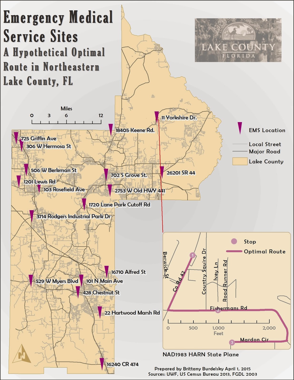 |
A map of Lake County, Fl with locations derived from geocoding.
Additionally, a hypothetical optimal route between select points is included
as a demonstration of the capabilities of the Network Analyst extension in ArcMap. |
I liked working through the Esri virtual course on model building and plan on completing the course in its entirety. Just like ArcPy, setting up a workflow makes automating tasks so easy. The exercise I completed looks at a prefabricated model to examine what is working within the model and what needs to be fixed (by altering input data or specifying information for a tool to run). Once the model was ready to run, it quickly buffered two layers, intersect those buffered layers, and then dissolved borders between intersecting buffered polygons. These tasks would have taken a lot longer to perform individually. {I am positive ModelBuilder will be my GIS BFF.}
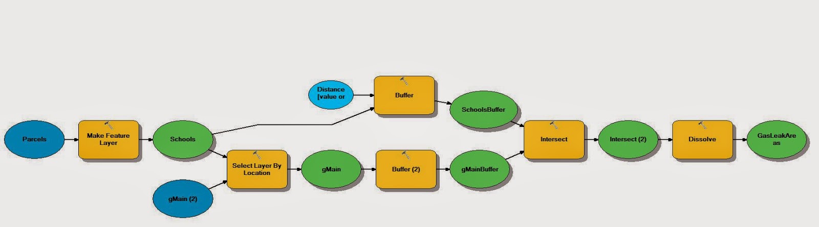 |
| A model that I successfully manipulated, altered, and ran as a result of an Esri virtual course exercise in model building. |
No comments:
Post a Comment