This module is all about data preparation (for labs in the coming weeks) and starts our foray into landscape archaeology. We walked through gathering data for international landscapes from the
USGS Earth Explorer. In particular, locating DEM data for an area in the Altai Mountains of Russia that contains known Scythian mound burials (also known as
kurgans). For this exercise we used
ASTER derived data. The
Mosaic to New Raster tool was used to stitch together four raster datasets and from there we digitized a boundary and clipped the larger DEM down to something more manageable.
The map deliverable shows the subset of data examined by way of a DEM symbolized with the elevation color ramp. It also highlights the area where the mounds are located with a georeferenced JPG.
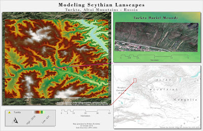 |
This week's deliverable highlighting a region in the
Altai Mountains, Russia that contains burial mounds. |

No comments:
Post a Comment